Inner Basin Adventure

You can camp year round in Arizona. You do have to pick your places as during the winter camping up north is out of the question, and in the summer camping in the desert would be a bit uncomfortable. My favorite camping in in the mountains where there are tall pines and aspen, grass and shade. The thing is, when the monsoon season hits (around July 4), it rains every day and I really hate camping in the rain. So when I got the invite to camp the weekend of June 5-7 in the San Francisco Peaks I jumped at the chance. The weather would be beautiful, it was before monsoon season and it was hotter than the seventh chasm of hell in the valley.

I get off work at 1:30 in the afternoon so I could bolt on up there right after. I would have the car packed and two of our camping party were going up early to snag a couple of skookums campsites at Lockett Meadow.

Of course it rained.

There are three basic physiographic regions in Arizona. Basin and Range, which includes the Sonoran Desert and the Phoenix area, the Transition Zone, which is chaparral, the areas around Payson, Sedona, and Prescott and last, the Colorado Plateau, which is high elevation and snow in the winter. The Colorado Plateau was where we were headed.
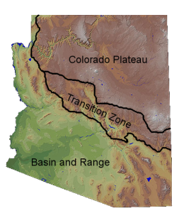
physiographic-regions-labels

The image is misleading as the Colorado Plateau should be green and the Basin and Range should be brown

As I left Phoenix, it was raining. But I had high hopes that it would clear off. As I headed up a mesa to the transition zone, which I refer to as The Riddermark, it got worse. However, when I got to Flagstaff it seemed to be clearing on one side and really dark and foreboding toward he east. Thank Dog we were going west! Lockett Meadow is located on the north east side of the San Francisco Peaks.  The Peaks were once a huge, cone-shaped stratovolcano that rose somewhere between 16,000 and 20,000 feet high and looked like Mt. Ranier in Washington or Mount Fuji in Japan.  About 250,000 years ago it blew it’s top and left behind several peaks and a nice place to camp called the Inner Basin. The actual campground is located in a place called Lockett Meadow. I tried to research where the name came from but could find nothing. My guess is it was named after some bloke named Lockett.

I got a text from Deb back in Phoenix that our campsites were going to be 14 and 15. Megs and Ken had already arrived and were setting up.  stopped for some firewood then headed on to the forest. I thought that the meadow was toward the bottom of the peaks. Boy, was I wrong about that. I headed in on the gravel road and it was still sprinkling. I still had high hopes that it would stop. Wrong again. Once I turned off FR 420 on to FR 552 (AKA The Fury Road) I saw a sign that said it was unmaintained, steep and curvy. Now, here’s something about me that part of my ‘wuss feature. I really hate and am terrified of driving narrow, steep, unpaved roads. But I tell myself I gotta do it. So I chived on. I bottomed out in a few places and was white knuckled on the steering wheel. I kept telling myself to stop whining, I’ll be all right. But some people are afraid of the dark, some are afraid of the number 13. My phobia is of driving on roads like this.

Like this but scarier

Like this but scarier

I’m yelling out loud, “Where is this f****** campground??!!!”. When I get higher and higher where it seemed to level off it really started raining. I was glad it was raining on the road as I was driving. I finally reach the campground and start looking for sites 14 and 15. I got to number 8 and there was Ken standing in the rain wearing a bright yellow rain poncho. I pull in and park. I had a huge golf umbrella in the car and it came I handy. Ken asked me if I wanted to sit in the car with them so I did. they said that they had to move from the original sites as the wind was blowing so hard they thought they were going to end up in Oz with the Munchkins. the left the easy-up (A portable shelter) down there and thought they would go get it when more people showed up.

After that we went to get the easy up. The wind was not kind to it and two of it’s legs were broken at the knees. We managed to take it down and get it in the car and drove back to the camp. Still raining. Megs’ daughter Hannah showed up with her partner, Hannah. The Hannah’s were like a well organized military unit. They had their tent up in about two minutes and then Little Hannah (aka McGuyver) built a fire in the rain. Then they built a lean-to using large sticks they found and a tarp. Meanwhile I got my tent up and furnished with Megs’ help. The lean to was going over the fire. It was at an angle so that smoke could escape. During the building of the lean to Megs and I were holding up the tarp while the Hanna’s finished off planting the poles and tying them down. It was then that Deb and Paul came in. They were thinking we were in 14 and 15 and kept going. They then came back around and we started yelling at them to stop. They kept going then stopped but we were all stuck hammering things and holding up tarps. They stopped a bit down the road then kept going. It was about then that Ken was trying to reconstruct the easy-up. They got the tarp secure and I hopped in my car to try and catch Deb and Paul. They were too far ahead of me and I found myself starting down the gravel road to hell. I stopped and did a very tight 3 point turn hoping to not crash into a rock or something.

When I got back Ken was still struggling with the easy-up, The Hannah’s were comfortable installed under the lean to and Ken says, “Fuck it, let’s go get a room in town!”. They didn’t have any blankets and Deb and Paul were supposed to deliver blankets. That was the perfect excuse to get the hell out of there and the freezing cold rain. Also, it started lightning.

As soon as we got into phone range I texted Deb to find out where they were. They said they got a room and said there were still enough rooms left. I texted Ray and told here where we were and soon we were all in Deb and Paul’s room having happy hour. It was nice sleeping in a warm dry room instead of the wet cold tent with lightning and thunder.

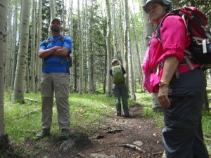
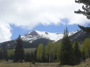
Next day we grabbed breakfast and headed up the mountain. The road wasn’t as bad as a passenger, I just have a phobia driving roads like that. The weather was clearing and things were looking promising. We went on a hike to Inner Basin and got as far as one of the many watersheds on the mountain and had lunch. there was a huge aspen grove that was stunning and when we got to the basin there was a great view of some of the peaks.

Photo courtesy of Deb

Photo courtesy of Deb

The next day was even more beautiful. We stayed till about 11:45 and then got headed out. I was once again white-knuckled, hyperventilating and crying with fear as I drove down that steep ass bumpy road. I was never so glad to get to the bottom. Next time. I am definitely riding with someone else driving.

Until next time

The Scubajedi

Click Register to follow my blog!
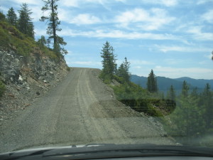
Photo courtesy of Deb

Photo courtesy of Deb

Annual Organ Pipe Cactus National Monument Easter Weekend Campout 2015

Every year a core group of friends get together and go down to Organ Pipe Cactus National Monument for and Easter weekend campout. I have been blessed recently with a Monday through Friday job where I get out of work at 1:30 in the afternoon, so this year I could jump in my car after work and head down. I had packed up everything non perishable the day before, so all I had to do on Friday was pop home to get my food for the cooler, tend to the cats and I headed off to Eden.

I left by 3pm thinking stupidly that might beat the traffic heading out of town. I was way wrong. It was bumper to bumper all the way from the confluence of the 60 and 1-10 through Buckeye. I got to the campsite about 6:30 and quickly got to setting up.


It was good to see everyone again as some of us only see each other once a year. Others of us regularly hang out as we are in a book club together, or just like to do things together. This annual even had been going on for over 16 years. I really enjoy it as I love to camp and though some years it can be a bit warm down there, the campground is really good and getting better as now there is SHADE!

Organ Pipe Cactus National Monument is located in southern Arizona, south of Ajo, west of Tucson, and east of Yuma. It borders Mexico and you can see it from there. The park was founded in 1937 by  President Franklin D. Roosevelt.

The park was created as a way to preserve a representative area of the Sonoran Desert. The new monument was part of a movement in the National Parks to protect not just scenic wonders but also the ecological wonders of the country. Over 75 years later, Organ Pipe Cactus is now one of the best preserved examples of the Sonoran Desert wilderness.

Within the monument, signs of human use are also preserved and protected. The monument is the site of culture and history that reflect long, widespread and diverse use by American Indian, Mexican, and European groups. The intersection of these of these three cultures is significant archeologically, geographically, and internationally. (Copied and pasted from here as I am too lay to regurgitate this information).

Those who show up on Friday evening usually just hang out and catch up. Some of is who get there early enough make the short trip in to Sonoyta, Mexico go to the steak house there to make reservations for the following evening as is tradition for us to eat Saturday night at the only good restaurant in Sonoyta. Also, there is a liquor/various sundries store called Vasquez where we buy good tequila, and some like to visit the pharmacia to get cheap over the counter drugs. I got there too late for that this year.

On Saturday we all usually go for a hike. Some like to treacherous long hike up Mt Ajo (which means garlic in Spanish), some like the kinder gentler hike to what is called Bull Pasture and others like me in recent years either site around at camp (when I had a broken toe), or go on even easier hike. Last year I went to what is called Dripping Spring. this is a little dribbly spring coming out of  a little cave in the rock and it is swarming with bees, so you don’t stay too long. This year a feature area called Quitoqibito spring in the south of the park. In past years it’s been closed because of illegal immigration activities and the only people lurking about in that area were the “Coyotes”, their victims and the border patrol.

The visitor center was giving tours of the newly opened area on Saturday so three of us decided to go. It was a 20 mile very bumpy ride out there, but you could see the “fence” they are trying to build to keep those pesky Mexicans out. Like the Great Wall of Arizona. It looks like something that can be climbed in like, 1 minute. It isn’t finished and when we drove further it was just a short easy to jump fence really just to indicate the border. Along the fence in a road that was built by FDR and is now patrolled by border agents. We drove parallel to this until we got to the parking area for Quitoqibito Spring.

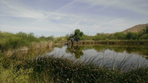
WP_20150404_004

We walked around the pond and up to the spring boil then back to the van after a long winded tour and lecture on the history of that area. Then we drove the bumpy road back to the  camp and saw a nesting great horned owl that looked like a cat sitting on a nest in a Saguaro.

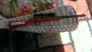
We got back and my friend Joan and I took to crocheting and everyone else that was back just kicked back and chatted. At 6pm we were all going in to Sonoyta for dinner. Then there was the great scuffle as to who was driving and who was riding with whom. I said I would drive and could take two more, but everyone pretty much found a ride and I Jon ended up with me, which I liked because he is a retired border agent. We were joking that I should bring my new lighter that is shaped like a bolt action rifle ha ha…

WP_20150314_001

We crossed the border which is getting scarier as they have much military posted at the borders now. But nothing happened and we went in and had dinner at the little steak house we always eat at. It isn’t the best but it’s the best in town.

Afterword, we headed back to camp. So here’s where it gets interesting. We were probably no more than 100 yards of American soil when I see the old blue and red lights in the rear view mirror. I said, “Oh shit, Jon, we’re getting pulled over, I haven’t done anything”. So I pull over and the officer approaches my car. I roll the window down and he asks if I speak Spanish. I say no, of course not your friggin idiot, do I look like I speak Spanish? Of course only the No part was audible, the rest were my thoughts. So he shows me the radar gun and he says I was going 58km in a 40km zone. I apologized, thinking he’s a liar and that radar gun is an etch-a-sketch. I ask what to do. He tells me I can go to the police station and pay the fine. I ask how much is the fine and he says $1000 pesos.  About $80 American dollars. I look at Jon and he’s just staring ahead and ask what to do and he says it’s up to me. Well, I didn’t have $80 on me so I tell the officer is there any other way, I don’t have any money. So he tells me he can take $60 and then I see what’s going on here. So I say what about letting me off with a warning and I will never do it again (which is true, I never plan on driving in to Sonoyta again). He then says he can take $40. All I had on me was $40, Jon offered to pitch in $20 and I said it’s okay, I just want to get out of here. So I gave the Highway Robber, I mean, Police Officer the $40 and got the hell out of there. Jon said he was very impressed with my negotiation skills.

Got back to camp and regaled the story around the campfire. Everyone was joking about what could have happened but all in all we were pretty lucky. It’s not going to go against my driving record, my insurance isn’t going to go up, and Mr Police Oficer probably got off duty and got with his other crook cop buddies to compare their hauls for the night. Also, if he would have searched the car he would have found my camping hatchet in the trunk and I would still be in jail down there instead of blogging about it.

One of the guys at camp said that I was in the No Hassle Zone which means that I didn’t have to stop, I could have just kept going. I questioned this and so did Jon. So when I got home I googled it and that is not what that means AT ALL. It means you do not need a permit to drive in that particular area. Between Sonoyta and Rocky point is a hassle free zone. When we go to San Carlo we stop at the 20-click mark and pick up a permit because we are going further into Mexico and you need a permit. So if I would have taken his advise (which was after the fact) and blown through like Thelma and Louise, I, again, would still be in jail down there.

Until next time, your Friendo Bandito,

The Scuba Jedi

Yavapai Campground Adventure

We wanted to do one more camp out before it got really cold out. Since we were going to be camping over Halloween and the next two days after, we had to find a campground that was going to be opened after October 31. Most of the National Forest campgrounds close up for the winter after Halloween. Our friend Sherri lives in Prescott and wanted me and Nunya to go up there somewhere.  I looked online for an open campground and could only find one in Payson.  Luckily Sherri got on the job and found a couple of option in the Prescott area. We had the choice of one just south of town and one just west of town. The west of town option sounded really interesting to me as it involved a trail from the camp that would take you to a lake nearby. Also, I love going to Prescott anyway.

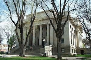
Prescott was officially incorporated in 1883, named after historian William H. Prescott. Today the city has 39,843 residents (U.S. Census 2010) and is a wonderful small town with a town square and courthouse surrounded by shops, restaurants and bars.

courthouse

Prescott Courthouse

I have Fridays off so I went up to the campsite first. I got a late start as I work until 1 in the morning and really needed to sleep in. I keep all my camp gear in the car for a fast getaway so all I really needed was clothing, ice and food.

The directions to the campground were rubbish. Very vague and I had no idea where to really go. Thankfully I was in text range and Sherri helped me out. The directions started you in Prescott saying to take Iron Springs Road going west out of Prescott, the take Forest Road 337 to the campground. That was it. I was way off. Finally Sherri called me and guided me to Iron Springs Road, which I never would have found. After that I was looking for Forest Road 337 and drove way past it because it’s really called Granite Basin Road. I turned around and finally found the right road.

I found the campground and picked out a spot. I thought it was going to be perfect as there were three spots for three cars, three flat spots for three tents and three tables! Perfect!

I started setting up my tent and the camp host, Doug, stopped by. Later I would be referring to him as Lt. Neidermeyer. He came off as soft spoken and all natural. He asked if I had paid for the site and that it was a double site. I said yes, I know and I have two friends coming later and we would pay up then. He then tells me that they are very strict with the noise level at the campground, that the grounds were like a bowl and sound travels far. Huh? Anyway, I started suspecting the guy was a little weird and passive aggressive. He said that some campers called the police on some others the previous night.

Sherri arrived when I was out for a walk around the bowl, uh, campground. She was setting up opposite of where I was set up. I mentioned that it was great that we had three tables, we could really spread out, like having our own little campground to ourselves!

We started a campfire and chatted away until Nunya finally got there and I turned in. The next morning I got up and the others were up and making coffee and getting breakfast ready. They then told me that someone called the cops on them last night. I was out cold and missed all of this. They said the Sheriff deputy came by saying someone called in for noise! When he got there they were just sitting by the fire and quietly chatting! They said the officer looked bewildered and frankly this was a complete waste of his time.

So the camp host, Doug, comes by and Nunya in her blunt style just asks him point blank if he called the cops on us. He then said several people did. Okay, so, there were two other camping parties nowhere near us, and we couldn’t hear them so it goes to say unless we’re screaming they can’t hear us chatting. Doug was the closest to us, so it was him.

Personally, I never understood why people go to the wilderness to listen to loud music and scream and holler. I go there for serenity.

Then Douggie asks us if we’ve paid for the second site. Again, huh? Turned out that the site Sherri was at was a separate site. I mean, it was totally glaumed on the the “Double Occupancy” site where Nunya and I were. The campground was empty except for us and the two other camping parties a ways down. So Doug either wants us to pay for the site Sherri was in or, she had to move her tent and her car, so our cars were now all blocking each other. All this because this douche-canoe couldn’t have the heart to just blow it off since it was cold out and there were no other people coming to camp. Even if there were, there were plenty of empty sites.

So we did as he said lest he come around and kill us in our sleep.

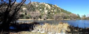
After that we took a short hike to Granite Basin Lake and had a good time joking around about the “noise ordinance”. Doug had told us we could be fined $200 per person if the cops wanted to cite us. I then said, “Well, when the cop comes out tonight I’m going to clarify that with him”. I’m such a smart-ass.

gbl

Granite Basin Lake

Turned out we were good doo-bees that night and no cops showed up.


Until next time, your out of control friend

The ScubaJedi


Please subscribe! Just click Register in the right column!


Reavis Ranch from Trail 109 North – Apache Lake

I think that women who have more than one child go through a denial phase where they forgot the pain and suffering they went through the first time and decide to do it again. This is what I think I experienced when  I decided to take my annual Reavis Ranch Birthday Backpack this year from trail 109 the North trailhead.  I had blotted out all the areas that were unpleasant and just too hard to do and enjoy.

Don’t get me wrong, I don’t regret anything, the views were spectacular, my hiking companions were terrific, and it’s just fun to camp out.

The weather was warmer than what I was hoping for, but still not too bad and the fact that we were going to be at a higher elevation would mean that it was cooler than home. Being the middle of October my fine friends up north are saying what?? Camp out in October?

The trailhead for Reavis 109 North is located off the Apache Trail. This is an improved unpaved road that takes you from Apache junction to Roosevelt Lake. I have only driven the road once in 1992 with my mother in a Pontiac Grand Am. I thought if I got out of there alive I was never going back. For someone coming from the flats of Florida to a steep unpaved narrow road through canyons with very high and immediate drop off’s it was scary.  But for the trail head, you go past a little group of buildings called Tortilla Flat and there is a sign for the trailhead. Then you get on an even narrower road with a few whoop-de-doos and roundabouts and viola, you are there. You do get a nice view of Apache lake and there is ample parking for cars, trucks and horse trailers. It is a popular trail for Chevaliers, Caballeros, and Cowboys.

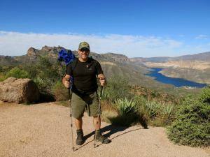
GeorgeTH

George at the trailhead. Photo courtesy of Nunya.


So we parked and hoisted our packs on. Once again, my pack was way too heavy. I don’t know why, water is the heaviest thing you carry and I only brought my one bag of water thinking, I never use the whole thing on one day hike and this is only 6 miles in. I never looked up the trail stats before this hike because I did it before, and the way in from the south is 6 miles and frankly, I was just negligent in my research and too cavalier in the idea that I remembered the trail.

It was me, my friends George, Nunya and George’s friend Nate. I later discovered that I knew Nate, but I’m getting ahead of my story. We started in about 9:30 am. George and Nate quickly got ahead because these two guys are trail monsters and get out and hike all the time. Nunya I know lagged with me simply to stay with me as I have gotten so out of shape for hiking and was struggling early on.

The trail has basically six segments, all of which I made up during this trip as to remember it all rather than the fun stuff. The first leg is what I call the approach to the Gap of Rohan. This is a gradual uphill trail to a small pass between some large boulders that I named the Gap of Rohan, as I am a Lord of the Rings fan. The trail, I might add, follows and old road bed that was laid down in I believe 1910. I can’t believe cars would have ever been able to drive on this, but I am sure the terrain has changed sine the ranch was abandoned and vehicles no longer go there.

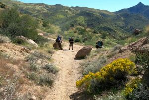
Resting at The Gap of Rohan. Photo courtesy of Nunya.

Resting at The Gap of Rohan. Photo courtesy of Nunya.

Once past the Gap of Rohan you are in the Riddermark, as you would expect. I call it this because it, well, looks like the Riddermark  in The Two Towers. Here is where you can really see where it is you have to go and here is when you start saying “Fuck Me!”.

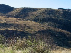
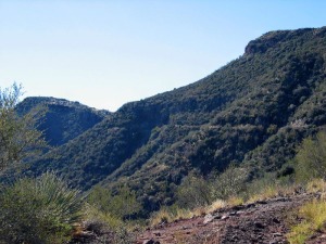
Photos of a hike to Reavis Ranch from the north in the Superstition Mountain Wilderness

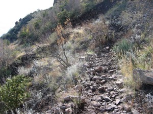
But, you plough on. There is a side trail to what is Called Reavis Falls and it is marked by some cairns. The trail leads up to another gap where the terrain changes and the trail leads up to a place called Windy Pass. When I say up, I mean up. 3,700′ at Reavis Trailhead to 5,100′ at Windy Pass. Not sure of the mileage, I cannot find the stats. The approach to Windy Pass also had me mumbling foul words. It was on the segment when my legs decided to cramp up. This segment is also insidious in that you go around several corners where you are thinking is this the last one and we’ll see the pass? No. You go around one corner only to see more trail going up over what I like to call, ankle-twisters. These are rocks roughly the size of a baseball or softball and they are loose. Depending on what muscles are being stressed in my legs and feet, is how my legs cramp up. When I say cramp up I mean to the point where I cannot walk. I was way too dehydrated and my legs were seizing. I really mean seizing because you could see the muscles ripple.

Photos of a hike to Reavis Ranch from the north in the Superstition Mountain WildernessPhotos of a hike to Reavis Ranch from the north in the Superstition Mountain Wilderness

We caught up to George and Nate who were taking a break, but I am sure just waiting for us as they didn’t really need a break, ever, as it seemed. I took some Emergen-C, which is an electrolyte replacement but I was too late for that. You need to take that stuff before you start cramping up. The others started up again and I trundled on behind them. I stepped up on a rock at one point and could literally not move. I started hollering and Nate came back to see if I was all right. I was not, but I wasn’t going to let HIM know that! I struggled along and at one point I did actually collapse and George had to help me up. This was bad.

We made it to Windy pass where we had a bite to eat and I searched for my Gatorade which I conveniently left behind in my fridge. After this I remembered that it was all downhill and just led you into Reavis Ranch. This is what I remembered but not what actually was. The boys had taken off and were far ahead. We went down the side of the hill from Windy Pass and I thought we’d be there soon. But that was not so. We passed a sign that pointed to a trail called Plow Saddle. I looked that up later and it sounded like an interesting trip, but we needed to forge on. The trail then went up onto what I called the Ridge Segment. By the time we got to the top, I was completely out of water. This has never happened to me before on a hike and I usually make fun of the people who do run out of water. Never underestimate your need for water. Nunya shared some of her water with me and that was enough to get to the campsite. It was after the ridge where it was all downhill or flat till you got tot he ranch area.

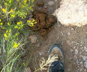
We knew we were getting close when we started seeing the apple orchard. From year to year, it varies on whether or not there will be apples, but this year must have been a good one. We saw lots of apples on the ground and in the trees, and judging from the size of the fresh bear scat we witnessed, the bears were enjoying the harvest as well.

Bear scat, photo courtesy of Nunya.

Bear scat, photo courtesy of Nunya.

We arrived and met up with the guys with just enough sunlight to pitch camp and pump water. The weather was good and not too cold at night. The next day we just repeated what we did the first day but going out the other way. I can honestly say this is a trail that is uphill both ways. I don’t think I’ll be taking this route again, but the views are spectacular and you can take a passenger car to the trailhead. The down side it the length of the trail and the exposure.

When we got back into Apache Junction we stopped at a place called The Hitching Post. It was a country-western themed restaurant/bar with really good wings.